Utility Mapping
Seeing What You Can’t See
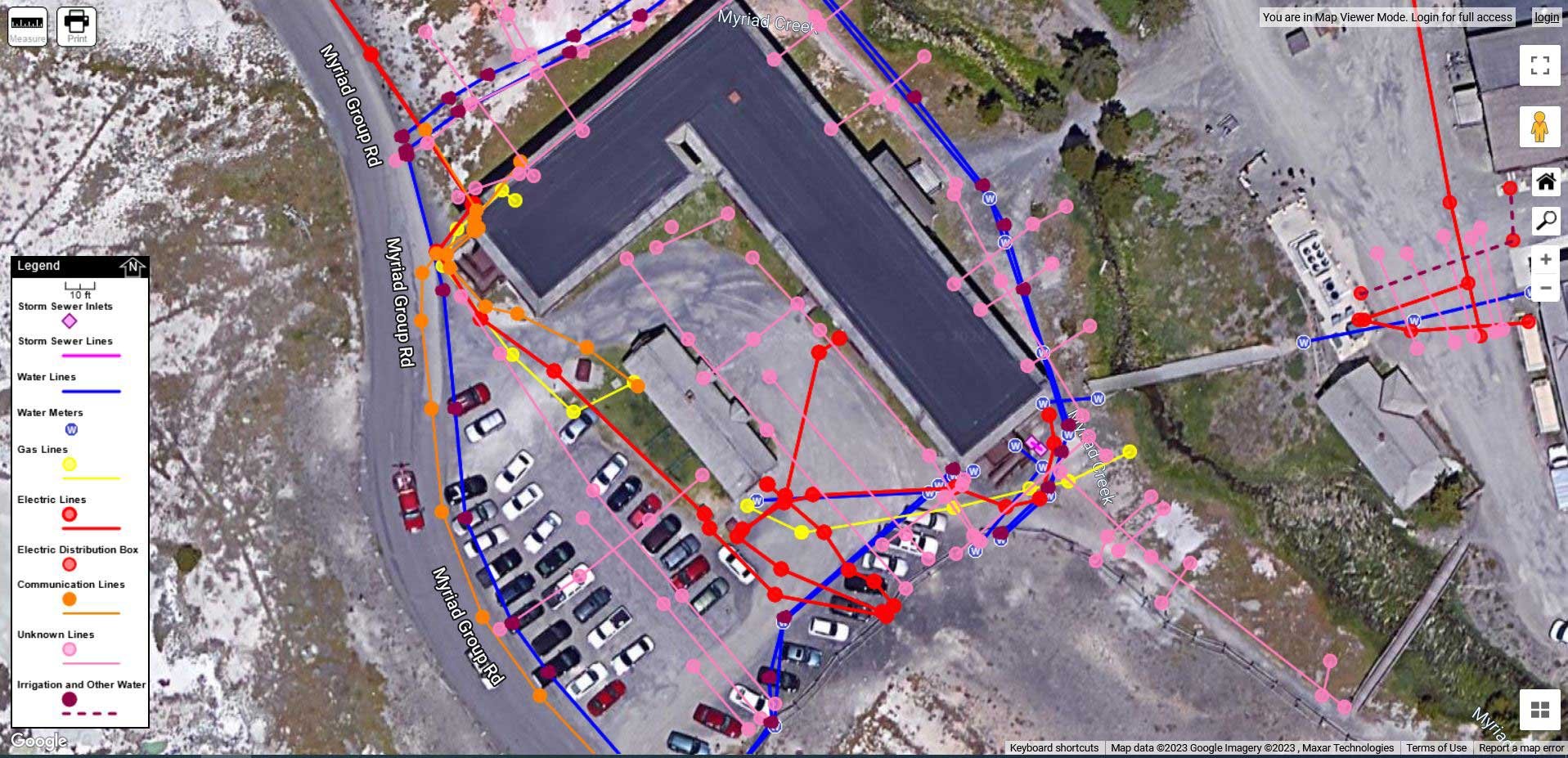
Store parking lot in Bozeman, Montana ->

Mapping of subsurface utilities providing centimeter grade accuracy.
Since the inception of our business, the need for accurate mapping of subsurface utilities that can be reproduced by contractors, engineers, airports, hospitals, universities, and a variety of other professionals in the utility industry is becoming more and more necessary.
Beyond the locating and marking of buried utilities, our customers can also benefit from our state-of-the-art mapping equipment and software, which is capable in most instances of providing centimeter grade accuracy. Using the Geode GNS2 Multi-GNSS 1 HZ receiver linked to mapping software, we can accurately place them on a Google Earth image of your project area using Global Positioning Data (GPS) to produce maps like the one shown below. Additionally, the way points can be imported into your GPS to locate your utilities on future projects.
With Geode GNSS Receivers, we can easily collect real-time GNSS data with sub-meter, sub-foot, and decimeter accuracy options.

Map created at
Old Faithful, Yellowstone National Park