
Cancer Center Locating Project

Purpose and Scope of Project
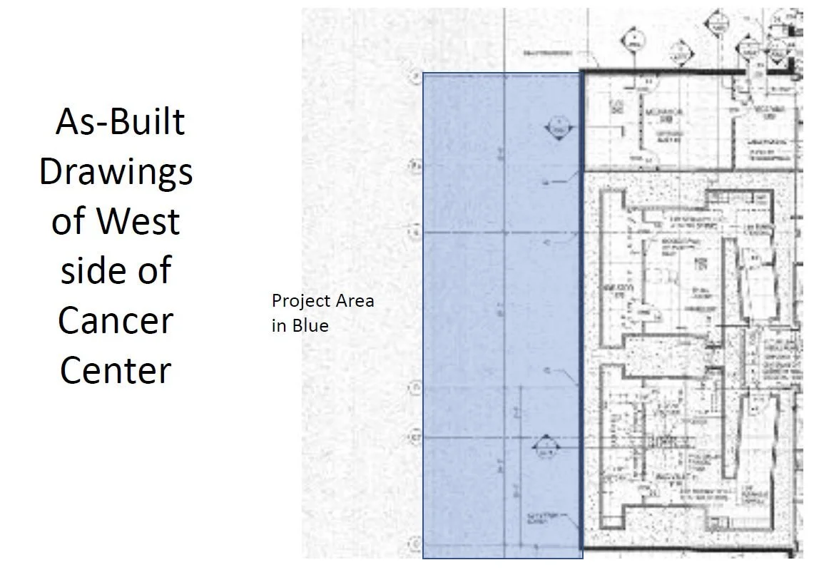
In conversation with Mr. Lavar Pitts and Mr. Darrin Highfill the purpose of this project was to locate buried underground utilities on the west side of the Cancer Center. An addition will be added on the west side of the building. Terracon will be completing a geotechnical boring to determine depth to bedrock and the lithology of the subsurface soil and rock materials in the proposed project area.
Project Description & Methods
Two methods of utility locating were employed at the project site. To perform GPR scanning a Q4300 Quantum Imager Triple Frequency System manufactured by US Radar was used at the site where surface conditions were compatible with GPR scanning.
To perform EM locating a Radio Detection 7100 TL with a 5 watt transmitter was used. Both of these locating tools are state of the art electronic equipment used in the practice of utility locating around the world.
The lines were located with both ground penetrating equipment (GPR) and electromagnetic (EM) locating equipment on radio mode, passive mode and then by direct connect when possible.


Results
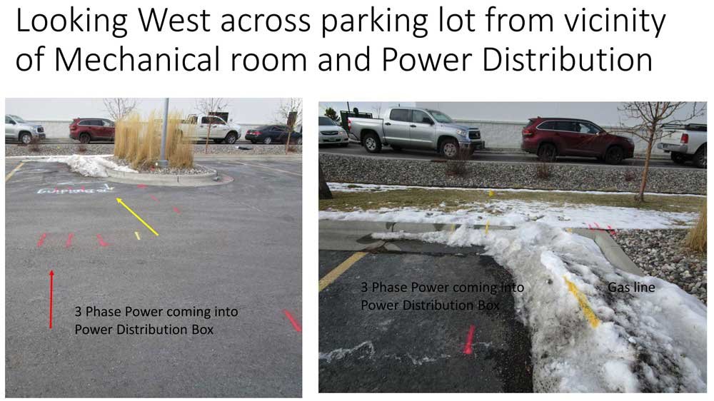
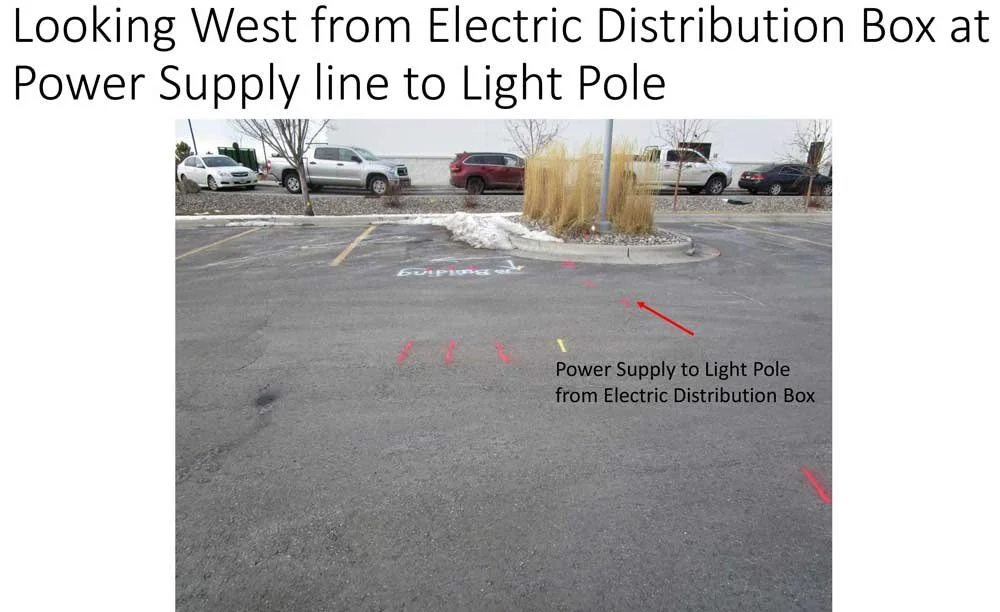
Soil conditions were not conducive to ground penetrating radar. However, faint GPR signatures were detected showing the location of probable utility lines, including water and the sewer lateral. The gas and electric lines could not be detected by GPR. They were located by EM locating methods on both passive and direct connect methods.
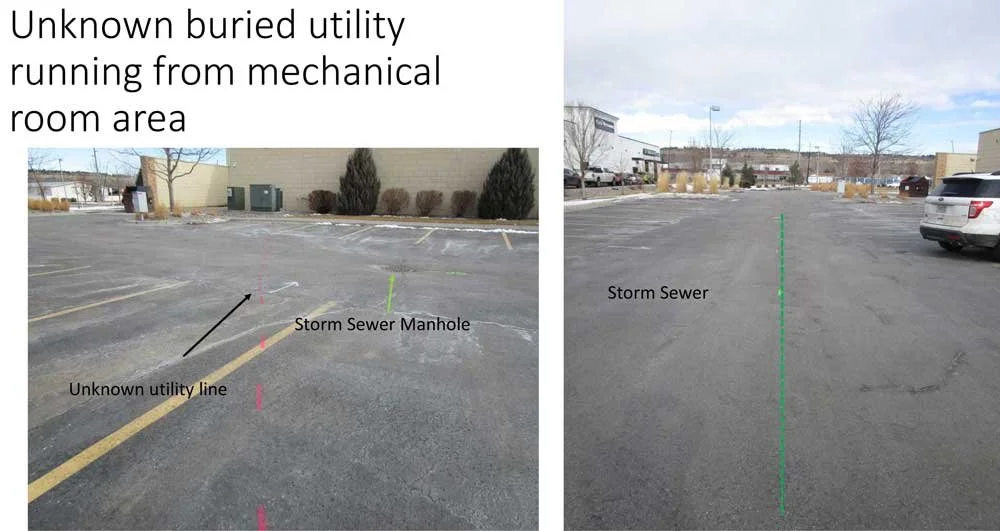
The location of communication lines could not be located since permission to access the communication pedestals could not be obtained. F iber optic and telephone line are likely located in the same area as the power and gas lines coming into the mechanical room.
The probable location of the water supply line and the sewer lateral was located using interpretive locating methods but not conclusively determined in the absence of as builts.
Conclusions
Natural gas, 3 phase electric, sanitary sewer, storm sewer, possible water supply lines and another potential underground utility line were located and marked. The location of communication lines could not be located since permission to access the communication pedestals could not be obtained.
The probable location of the water supply line and the sewer lateral was located using interpretive locating methods but not conclusively determined in the absence of as builts.